Sunday, July 29, 2012

June 2012
Olympic National Park: Coast Hike

We recently spent a week in Washington for our vacation.  We ate and drank our fill in Seattle, then headed out to the coast for a beach hike in Olympic National Park.  This was supposed to be a 3 day, 2 night backpacking trip.  We flew with all of our camping and hiking equipment from Arizona.  Unfortunately, living in Arizona, we forgot about factoring weather into the equation.  It was raining the day the hike started and was supposed to have storms and 40 knot (46.1 MPH) winds the entire next day.  Not my idea of a fun beach backpacking trip.  The kicker - the overland trails had sections of 5 inch mud.  Made for a very messy and long day hike.  When we got to camp, we decided to call it quits, turn around, and hike back to the car.  Well, at least we learned something!

The start of the hike out to Third Beach

On the way to Third Beach

Entering Third Beach

Third Beach/Strawberry Bay

Jackie at Third Beach

Aaron at Third Beach

Once we reached Third Beach we ran into two rangers, who asked us about our plans (and probably thought we were crazy for heading out in the bad weather!).  They indicated that the marker for the overland part of the trail was missing, but indicated that if we walked out towards the waterfalls, we had gone to far.  The way up proved harder to find than we thought, but eventually we found the rope to pull ourselves up the muddy bank.  The next several miles included ropes, stairs, and very muddy trails.

Pulling myself up the trail

These stairs are much harder on the way down!

Pulling myself up the stairs
Much of what happened after this point that was NOT photographed.  We ran into another overnight hiker, who was heading out alone.  We had to hike over some cliffs with the tides right below us.  When we made it to Giants Graveyard and Strawberry point, where there was a 4 foot tide zone.  The tide was MUCH higher than 4 foot when we reached it and so we knew we couldn't go on.  Wet and tired, we headed back to a campsite we saw above Scotts Bluff.

On the way back, some of the gound crumbled under me and I started to slide off the edge of a cliff (with the ocean 20 feet below me).  Aaron had to help me get my backpack off so that I could use my poles to help get back up the side of the cliff.  Not my favorite moment of the trip, but there were no tears, which means it was a success!

Once we made it back to the campsite, we contemplated setting up camp and trying to keep everything dry, but eventually agreed to head back to the car and find a dry place to sleep. 

These are happy faces on the way back to Third Beach


Sunday, July 22, 2012

May 2012

Hells Gate Trail

Trail Notes:  We found this hike in A Falcon Guide: Hiking Arizona.  The hike is east of Payson and was pretty easy to get to.  It should be noted that the turn off of Highway 260 is unmarked.  We passed it and then had to head back.  The hike is about 18 miles (based on our iphone GPS) out and back with about 2000 ft elevation change.  There are several campgrounds at the end.  We saw no other hikers the entire trip - until we reached the campground and happened upon two other couples.  We took an open campsite they pointed out to us, which was quite nice.

We did this hike as a 2 day backpack trip - our first trip to try out a lot of our hiking purchases.  It was hard for me to get used to hiking with a pack - and my pack was much lighter than Aaron's!  It was a good but TIRING hike!  We started on Saturday around noon - we should have left early Saturday morning to enjoy the campground, but we didn't realize how long the hike would take.  

Welcome to Hells Gate

Happy at the start of the hike

Cairns/Blazes marked the route

Beautiful views

Our campsite
The canyon narrows - we camped at the confluence of the Tonto and Haigler Creeks
More of the narrows
Aaron crossing the creek in the morning
Lovely morning view

Aaron on the hike back

 February 16-18, 2012: 

Wilson Mountain Trail, Montenzuma's Castle, IMS Half Marathon, and Hieroglyphic Trail

Aaron's parents came out to visit this past February.  We did so much while they were here: hiked in Sedona, visited the Lowell Observatory in Flagstaff, ran our first half marathon, hiked in the Superstitious Mountains, ate A LOT of good food.  I wanted to share some pictures with you below!

Wilson Mountain Trail

We headed up to Sedona Friday morning.  Sedona is quickly becoming one of my favorite places in Arizona.  In my opinion, the red rocks rival the most beautiful views in the US. 

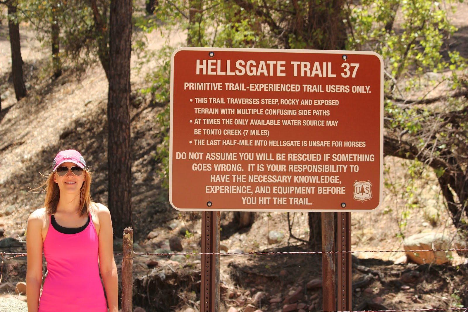
Trail Notes:  We found Wilson Mountain Trail in A Falcon Guide: Hiking Arizona.  This was Aaron and I's second time hiking this trail.  Pictures cannot express how gorgeous this area is. The book indicates a 5 hour hiking time, but it took Aaron and I about 2.5 hours (6.1 miles) in good weather.  We didn't complete the entire trail when we hiked with his parents since we wanted to keep our legs fresh for the upcoming run.  The trail is located 2 miles north of Sedona.  There is a (very) small lot just over the bridge north of Sedona.

Along the Wilson Mountain Trail outside of Sedona:


Montezuma's Castle

After hiking in Sedona, we headed to Flagstaff for some food, stargazing, and sleep. Saturday we were heading back to Scottsdale and we stopped at Montezuma's Castle on the way back.  It was a little underwhelming for me.  There is something to be said about a long, hard hike to get to gorgeous views.  Paying $ (or using your America the Beautiful card) to walk 1/4 mile on a paved road doesn't quite do it for me.  Check it out:


IMS Half Marathon

 On Sunday, Aaron and I ran the IMS Half Marathon.  We will be doing the FULL IMS Marathon next February!  Here's us at the finish!


Hieroglyphic Trail

After filling up on some Chipotle, we headed out to the Superstition Mountains to hike Hieroglyphic Trail.  It is a beautiful & fairly flat hike which was about all that I was up for that day.  When we made it to the petroglyphs, many had been vandalized, which was disappointing.

Trail Notes:  We found this trail in 60 Hikes Within 60 Miles: Phoenix.   The hike is approximately 3 miles (there is an optional hike the the Ridgeline at the end) and takes about 2 hours.  The trail is easy and the views are amazing.